Breaking
New Google Maps Images Show Devastation in Gaza: Entire Neighborhoods Wiped Off the Map
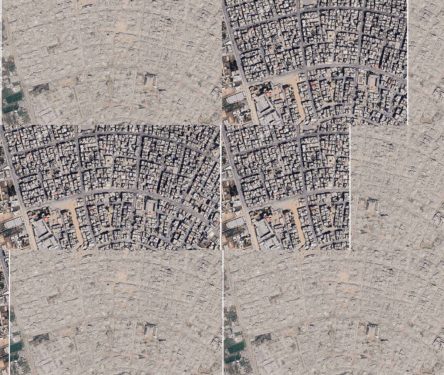
New satellite imagery from Google Maps reveals extensive destruction across Gaza, showing former residential neighborhoods reduced to sand and rubble. Images from Rafah, Jabalia, Khan Younis, and Gaza City highlight the scale of devastation, with UNOSAT data indicating that approximately 81 percent of all buildings were damaged by October 2025. Specific sites, including the Istiqlal Mosque in Ma'an and the Gaza City port, have been largely destroyed or severely damaged. The conflict has displaced hundreds of thousands, with many forced into humanitarian zones like Al-Mawasi, which are now crowded with tents. Access restrictions have tightened significantly, with nearly 65 percent of Gaza under strict Israeli control as of June. According to Gaza’s Ministry of Health, 74,016 Palestinians have been killed since the war began, while the UN reported 1,402 new deaths following the October 2025 ceasefire announcement. Israeli Prime Minister Benjamin Netanyahu has stated intentions for the military to eventually control 70 percent of Gaza.
Ozetta summarises; the reporting is the newsroom's